
Coal Illustrations and Maps
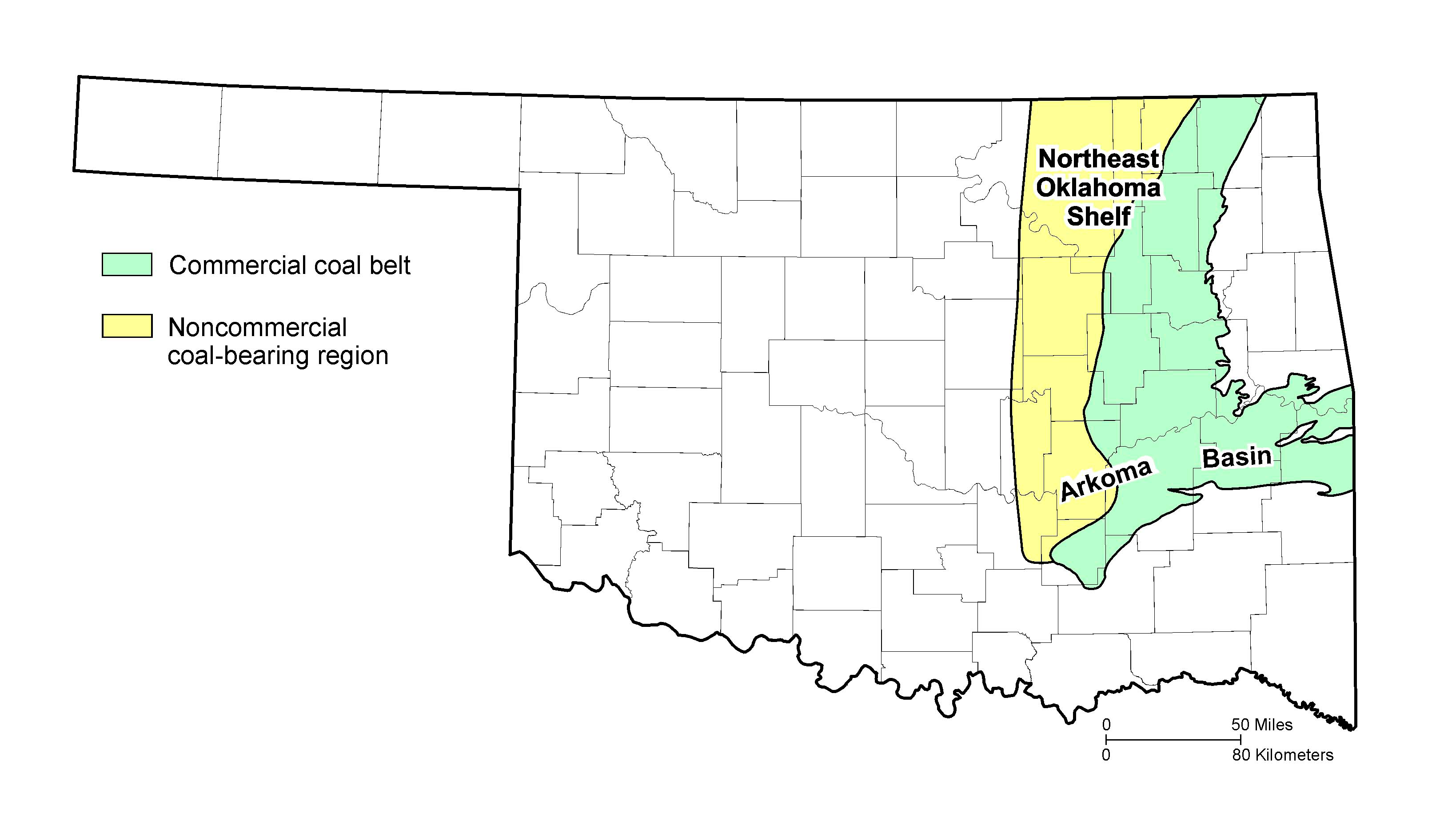
Map of Oklahoma Coalfield (PNG)
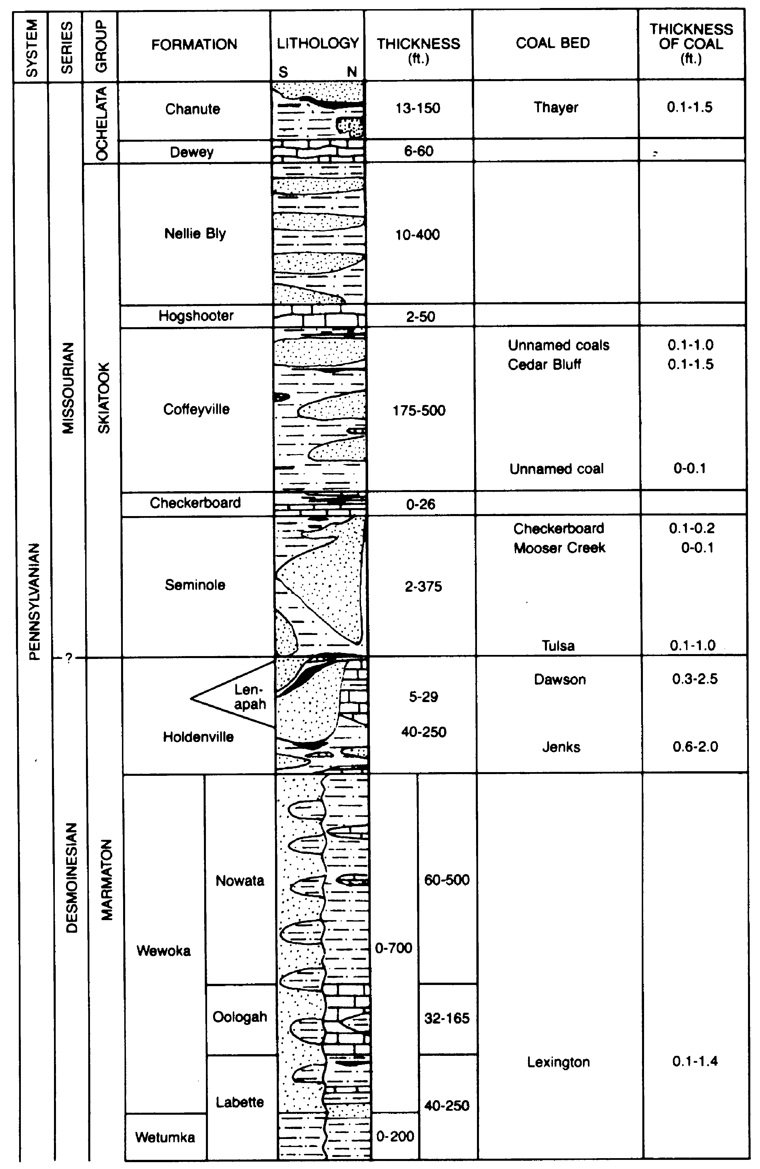
Northeast Oklahoma Shelf Stratigraphic Column Upper (PNG) & Column Lower (PNG) - Generalized stratigraphy of coal-bearing strata of the northeast Oklahoma shelf.
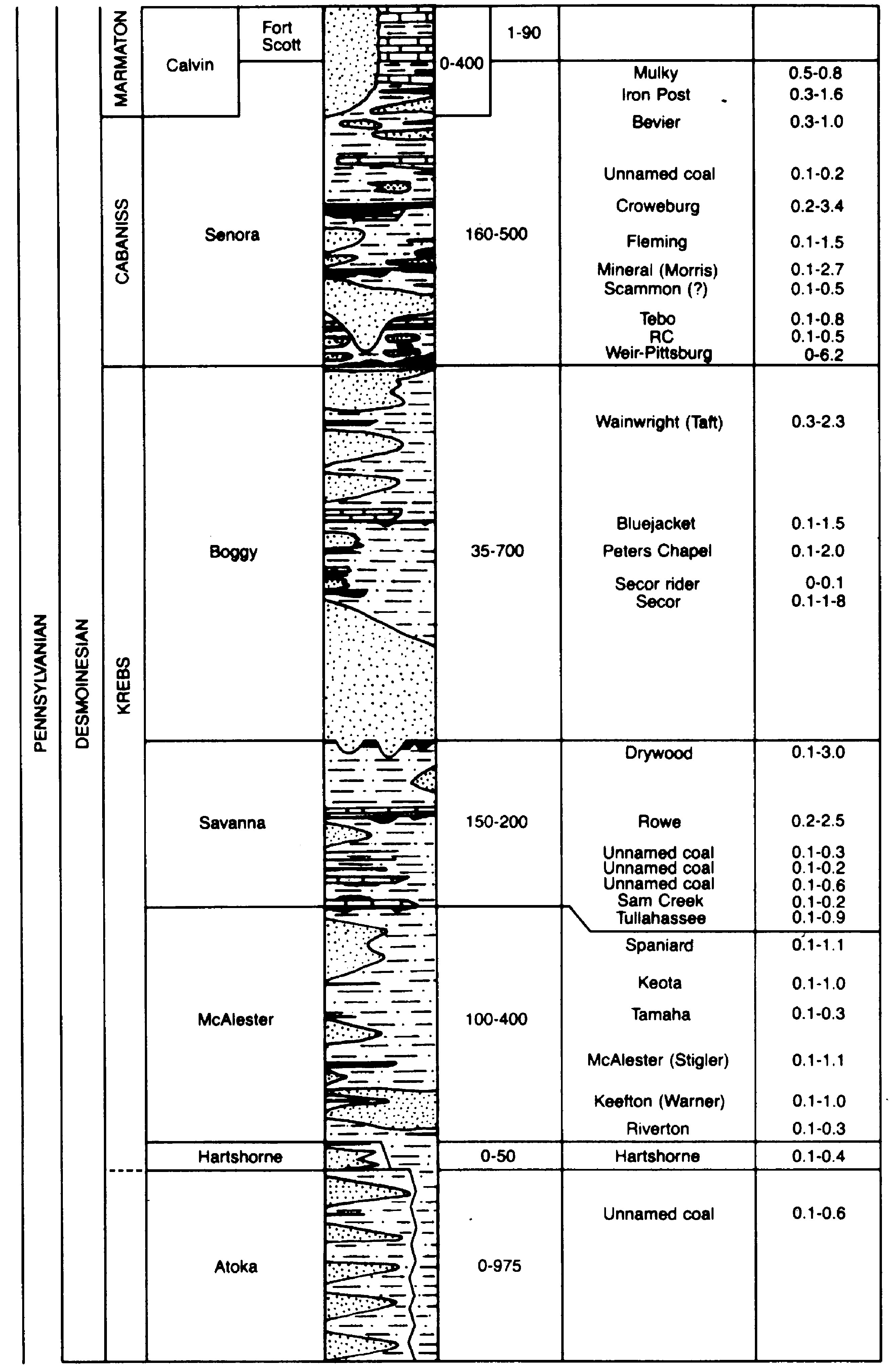
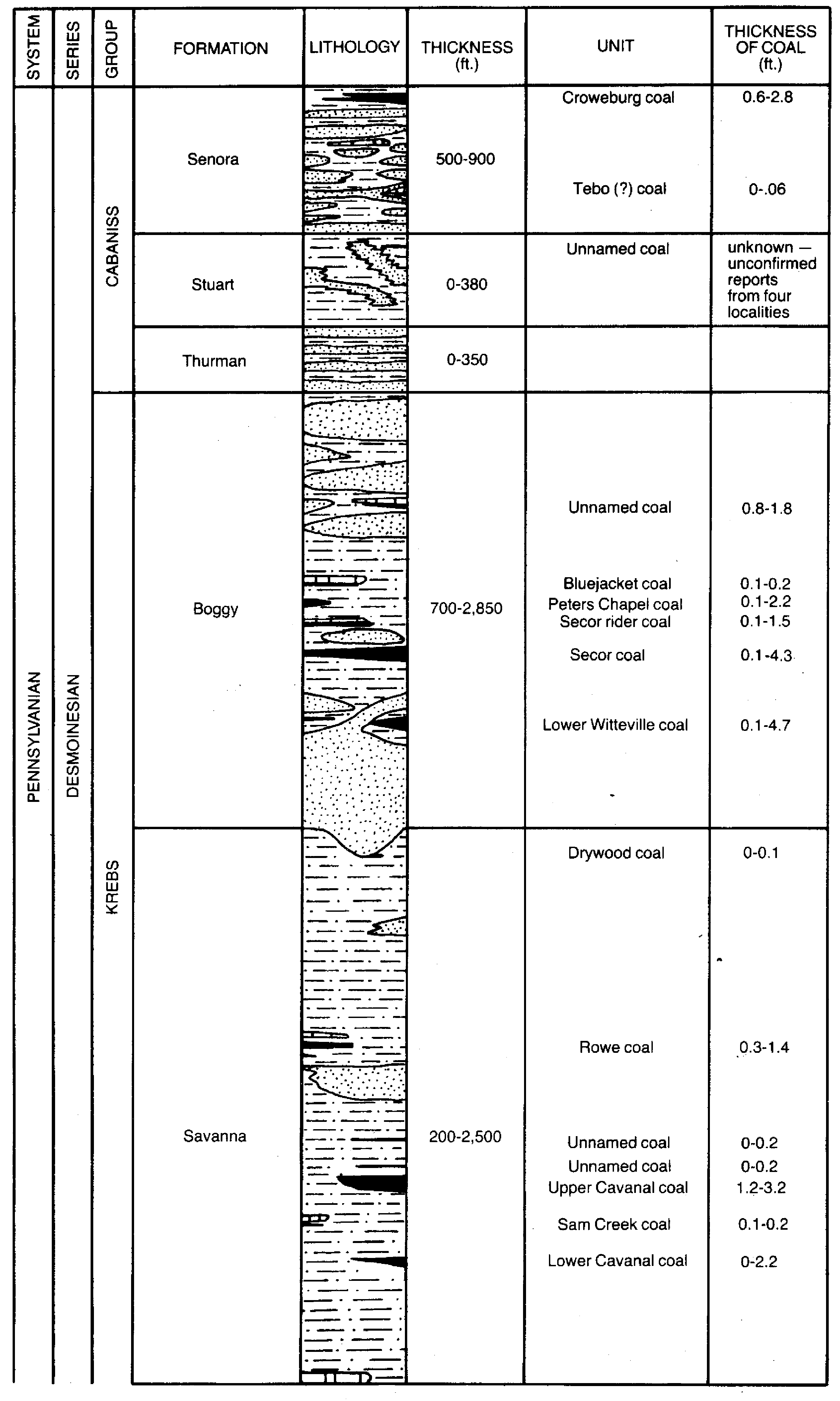
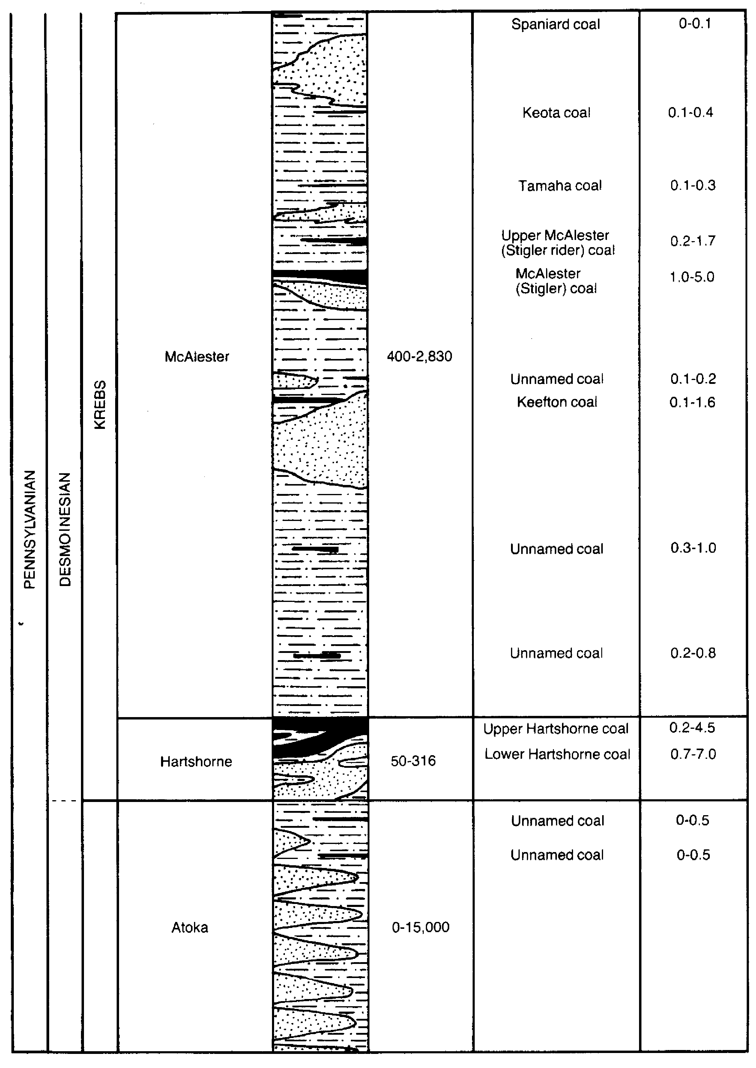
Arkoma Basin Stratigraphic Column Upper (PNG) & Column Lower (PNG) - Generalized stratigraphy of coal-bearing strata of the Arkoma Basin.
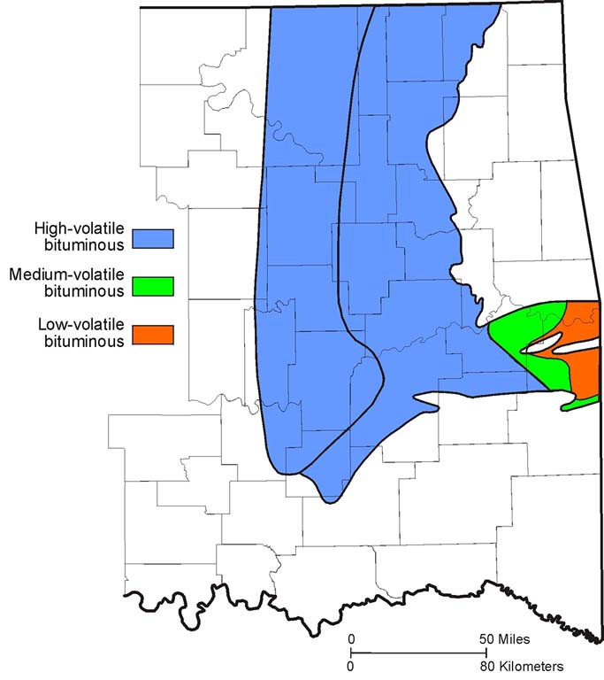
Coal Rank (JPG) - Generalized rank of all coal beds at or near the surface in the Oklahoma coalfield.
Hartshorne Coal Rank (JPG) - Map based on vitrinite reflectance of surface and subsurface samples of Hartshorne coal (Cardott, 2013).
Coal Production Graph (PDF) - Coal production in Oklahoma from 1873 to 2020.
CBM Completions Histogram (PNG)
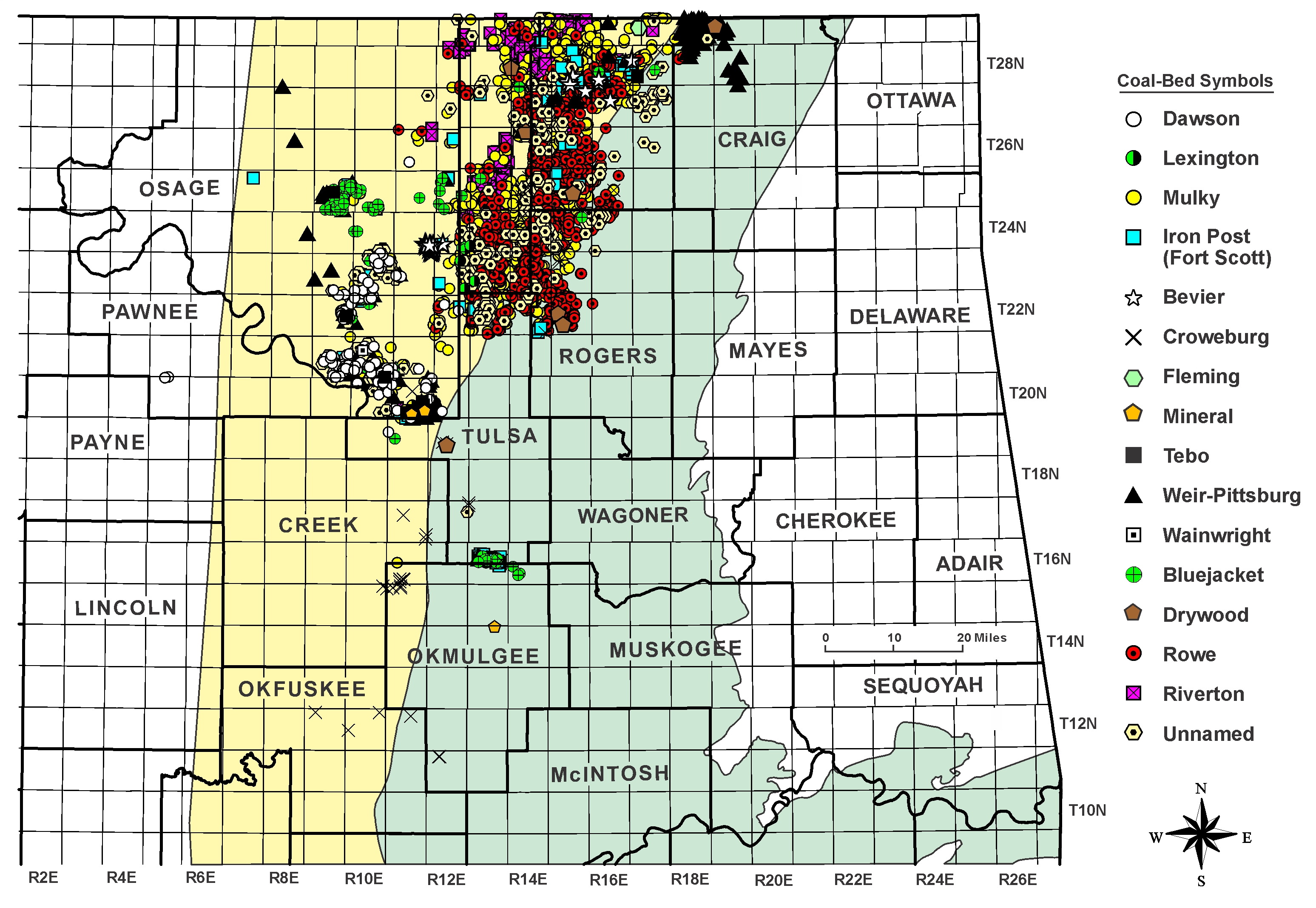
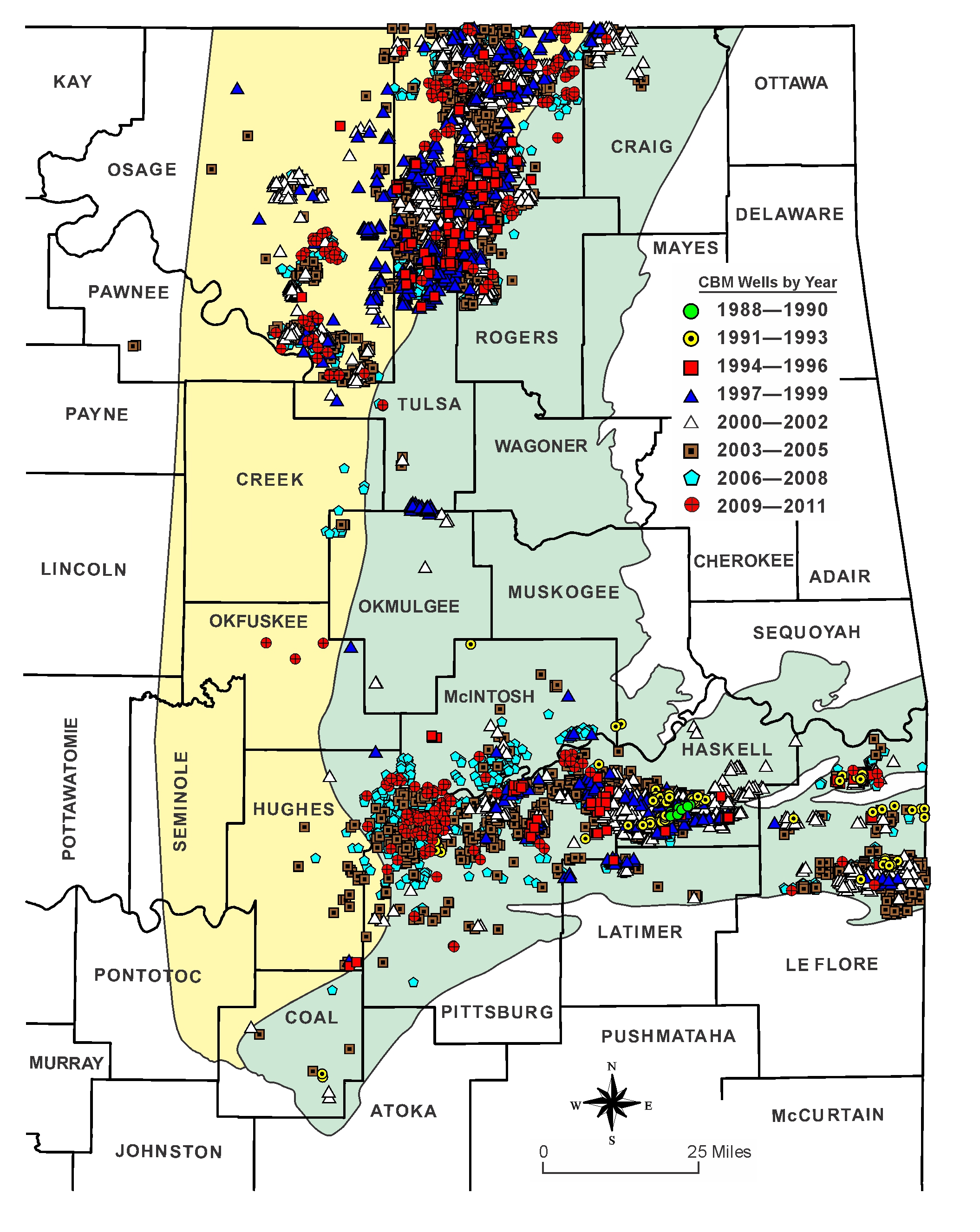
Northeast Oklahoma Shelf Coalbed-Methane Activity 1994-2011 (JPG) - Distribution of coalbed-methane well completions by coal bed in the northeast Oklahoma shelf.
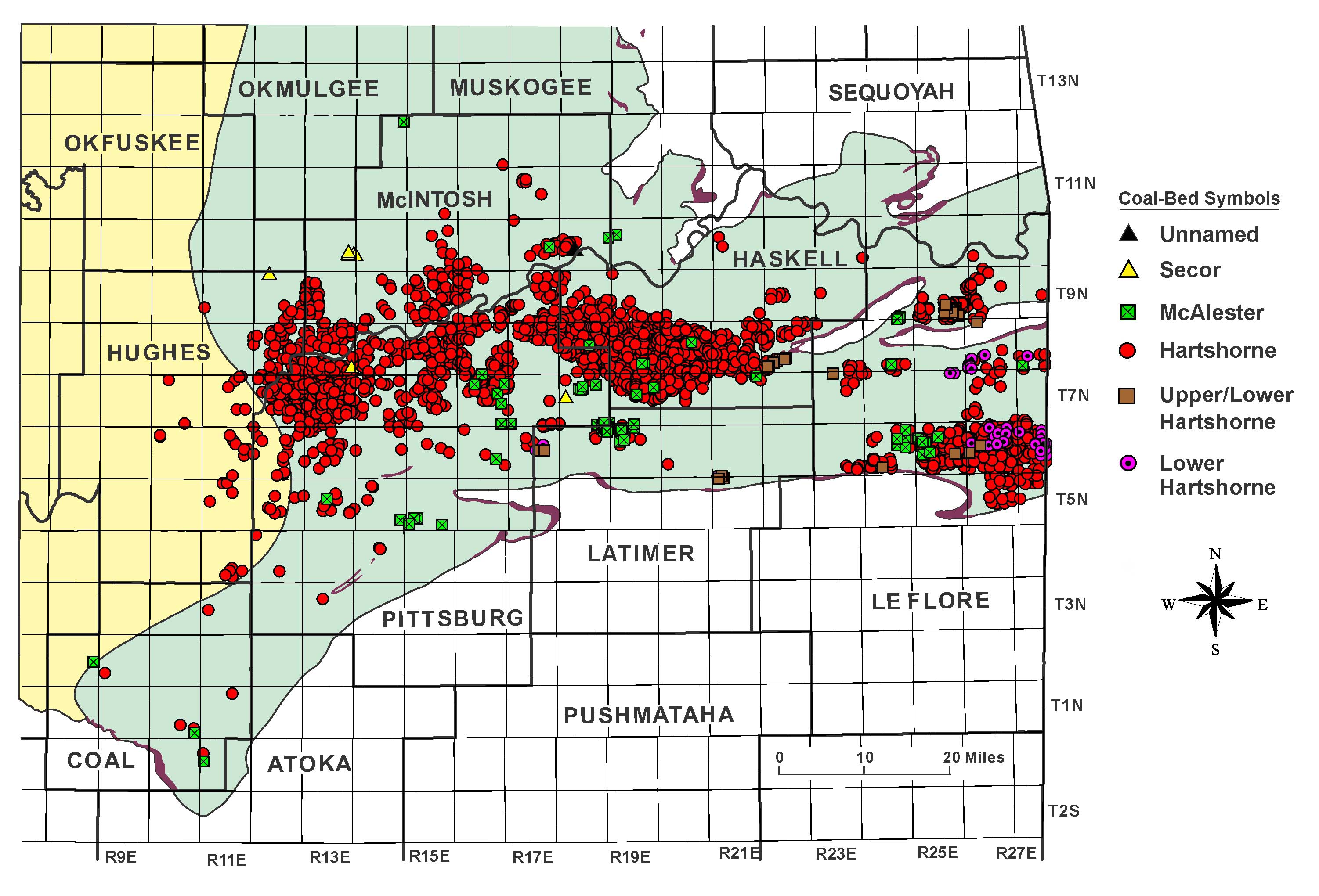
Arkoma Basin Coalbed-Methane Activity 1988-2011 (JPG) - Distribution of coalbed-methane well completions by coal bed in the Arkoma Basin.
Coalbed-Methane Completions by Year 1988-2011 (JPG)
Miscellaneous Map 16 (PDF) - Map of Eastern Oklahoma Showing Active Coal Mines During 1975 (January 1, 1976), compiled by S. A. Friedman. September 15, 1976. Scale: 1:500,000.
Miscellaneous Map 17 (PDF) - Map of Eastern Oklahoma Showing Active Coal Mines (January 1, 1977), compiled by S. A. Friedman. July 28, 1977. Scale: 1:500,000.
OGS Geologic Map 24 (PDF) - Map of eastern Oklahoma showing locations of active coal mines, 1977–79, compiled by Samuel A. Friedman. Includes tabulation of 29 coal mines and coal data. Scale 1:500,000. 1982.
OGS Open-File Report 1-2008 (PDF) - Map Showing the Distribution of Underground Mines in the Lower Hartshorne and McAlester Coals in the Adamson 7.5' Quadrangle, Pittsburg and Latimer Counties, Oklahoma, by S. A. Friedman. 1 sheet, includes 1 table and annotations. 2008.
OGS Open-File Report 7-96 (PDF) - Map showing the distribution of underground mines in the Hartshorne and McAlester coals in the Hartshorne 7.5' quadrangle, Pittsburg and Latimer Counties, Oklahoma, by Samuel A. Friedman. 1 sheet; scale 1:24,000. 1996.
OGS Open-File Report 52-2004 (PDF) - Map showing locations of underground coal mines in eastern Oklahoma, by Samuel A. Friedman. Compiled in 1979 in cooperation with Oklahoma Conservation Commission and U.S. Department of the Interior Office of Surface Mining. Scale 1:250,000. 2006.
