Skip Navigation

OU and OSU Take Off to Support Atmospheric Research

Skip Side Navigation
August 19, 2020

OU and OSU Take Off to Support Atmospheric Research

During August 2020, teams from the University of Oklahoma (OU) Center for Autonomous Sensing and Sampling (CASS) and the Oklahoma State University (OSU) Unmanned Systems Research Institute (USRI) joined forces at OU’s Kessler Atmospheric and Ecological Field Station (KAEFS) to conduct innovative atmospheric research using unmanned aircraft systems (UAS) or drones, which could lead to improved weather forecasts. Both the OU and OSU teams are developing and testing state-of-the-art UAS, instrumented with meteorological sensors designed to collect precision atmospheric data in the Earth’s lower atmosphere, which can be ingested by weather forecast models. Despite the challenges of COVID-19, the scientists and engineers from CASS and USRI were able to maintain safe practices and socially distance as they worked to together to push the envelope of UAS atmospheric research. 

The drones being operated by the two teams consisted of quadcopters and fixed-wing aircraft, which will be used in the Oklahoma UAS Targeted Flights for Low-level Observations of Weather (OUTFLOW) project. OUTFLOW is jointly funded by the Office of the Vice President for Research and Partnerships and Cooperative Institute for Mesoscale Meteorological Studies (CIMMS). One goal of the project is to use data from the drones together with other measurement systems in real time to improve short-term weather forecasts and to advance NOAA’s Warn-on-Forecast concept. The OU and OSU teams partnered with the Oklahoma Mesonet and were able to use data from the Washington (WASH) Oklahoma Mesonet station when validating the data collected with the different UAS during the test flights.


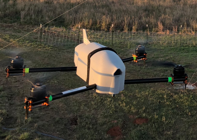
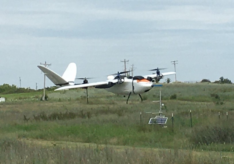
As part of the testing at KAEFS, coordinated flights were successfully conducted using three aircraft, which were controlled by on-board, pre-configured autopilot systems. In one configuration of the testing, two quadcopters ascended in unison to a height of 1,500 m (4,921 ft) above ground level while a fixed-wing aircraft executed a helical ascent in tandem with the quadrotors. The resulting data offer new insights into the structure of the lower atmosphere. Each university received approval from the Federal Aviation Administration (FAA) to conduct the flights. During operations, ground-based visual observers monitored the airspace near the flight operations to avoid possible interactions with piloted aircraft (airspace deconfliction).

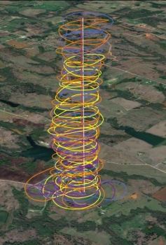
Moreover, the joint measurements allow the teams to assess the accuracy and representativeness of the atmospheric data collected. During the flights, all vehicles were collecting measurements of pressure, temperature, humidity, wind speed, and wind direction. The image below is a depiction of four different sets of coordinated flights. Analysis of the data for is ongoing as part of preparations for OUTFLOW, which has been rescheduled for Spring 2021.

For more information regarding CASS or OUTFLOW, you can follow the team on Twitter (@ou_cass) or contact Dr. Phil Chilson (Director) or Dr. Liz Pillar-Little (Assistant Director).