The Cooperative Institute for Severe and High-Impact Weather Research and Operations (CIWRO) was established in 2021, and extends cooperative programs between the National Oceanic and Atmospheric Administration (NOAA) and the University of Oklahoma (OU), which has continued uninterrupted since 1978.
CIWRO provides a partnership that links the scientific and technical resources of OU and NOAA. CIWRO scientists and students conduct research in weather radar and operations, mesoscale and stormscale modeling, forecast applications improvements, subseasonal-to-seasonal prediction for extreme weather events, and social and socio-economic impacts of weather in coordination with federal scientists across NOAA labs and line offices. CIWRO is one of 16 NOAA Cooperative Institutes. The partnership between the University of Oklahoma and NOAA fosters fundmental and applied research in diverse fields and provides NOAA the opportunity to engage with university knowledge and resources while allowing for students and university researchers direct experience in focused research and research to operations transitions.
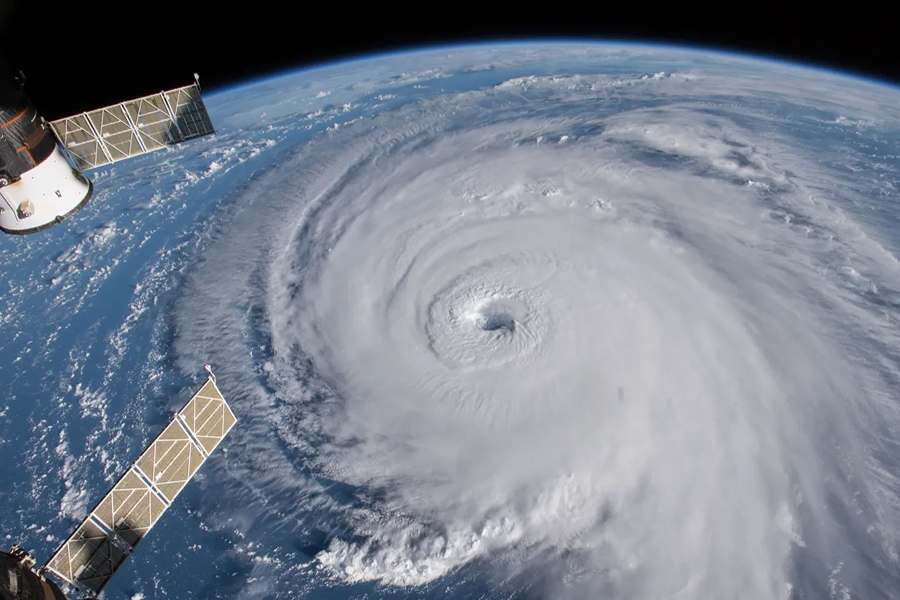
CIWRO research contributes to the NOAA mission by improving the observation, analysis, understanding, and prediction of weather elements and systems and weather anomalies ranging in size from cloud nuclei to multi-state areas. The continued advances in observational and analytical techniques lead to an improved understanding of the evolution and structure of these phenomena that provides more accurate prediction of hazardous weather and anomalous regional climate. This in turn contributes to improved social and economic welfare. Because small-, meso-, and regional-scale phenomena are important causes and manifestations of severe weather, CIWRO research furthers the understanding of the global weather system and regional weather variability. Altogether CIWRO promotes collaboration between researchers at OU and those within NOAA, by providing a center where these two groups may work together to learn about, and apply their knowledge of, mesoscale weather and regional-scale high impact weather processes.
CIWRO research is organized by five key themes set by NOAA Cooperative Institute Administrative Office.
To accelerate the transfer of knowledge between the meteorological and engineering communities (in academia, and government and private laboratories) to improve the design, usability, and supportability of the NEXRAD WSR-88D Doppler weather radar.
To understand cloud and mesoscale dynamics, microphysics and the precipitation process and their relationships to large and small scale forcing, and to develop procedures for assimilation of meteorological data into simulation and prediction models of these processes. The work done here represents a fundamental building block for eventual applied techniques.
To accelerate the transfer of research knowledge and skills between the academic and NOAA operational meteorological communities to both improve the design and utilization of weather observing systems and improve weather analysis, prediction and warning products.
To extend and apply the understanding of mesoscale processes to the problem of climate maintenance and change and S2S predictability in the context of extreme events.
To estimate the societal and socioeconomic impacts and values of stormscale and mesoscale high-impact weather systems and regional-scale climate variations of extreme events to facilitate the mitigation (enhancement) of the adverse (beneficial) impacts.
CIWRO research profoundly impacts every community in the United States by tapping into science to develop products invaluable in weather forecast operations. By stretching the boundaries of current technology and developing new inventions that detect severe weather with newfound speed and accuracy, CIWRO research is leading the way to better forecasts that save lives and property.
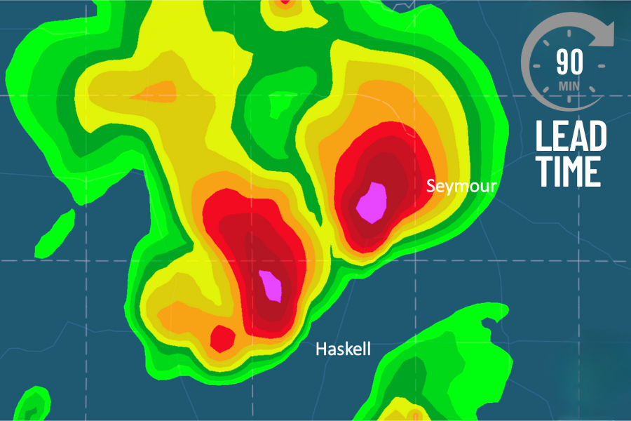
The Warn on Forecast System is a high-resolution, fast-updating weather model designed to provide earlier watches and warnings for high-impact weather
The accuracy and speed of WoFS have been demonstrated numerous times over the past several years, including examples in which residents received up to 90 minutes lead time. The average warning time is 13 minutes with traditional weather radar.
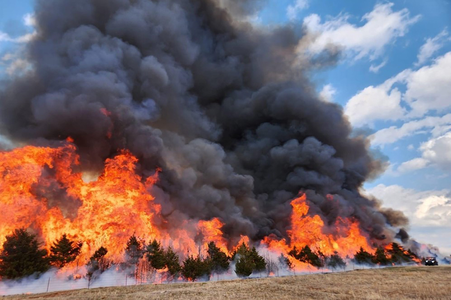
CIWRO researchers have been contributing to numerous aspects of fire weather science through advancements in radar technology, short-term high-resolution modeling, and social science research. All of these advancements will improve both the forecasting and communication of wildfire threats to first responders and the public.
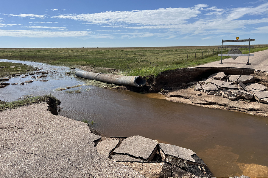
Flash flooding is the deadliest and costliest short-fused severe weather hazard on average in the United States. Research efforts conducted at CIWRO are directed toward improving the understanding, prediction, and warning of flash floods and post-wildfire debris flows. These efforts focus around the Flooded Locations and Simulated Hydrographs (FLASH) system.
Tornadoes, flash floods and wildfires happen every year – and the greatest impact is to people. Understanding how people receive warnings and respond to these weather dangers helps ensure the success of new meteorological tools, technologies and communication strategies developed at CIWRO. The Social Science Research Team conducts research that helps to reduce the impact of dangerous weather on society.

Artificial intelligence and machine learning have enhanced weather prediction modeling at an incredibly rapid rate. Rather than relying on physics alone to predict severe weather conditions, AI learns from historical data to give forecasters a glimpse into what storms may form. AI data is a valuable tool that human forecasters use along with traditional weather models.
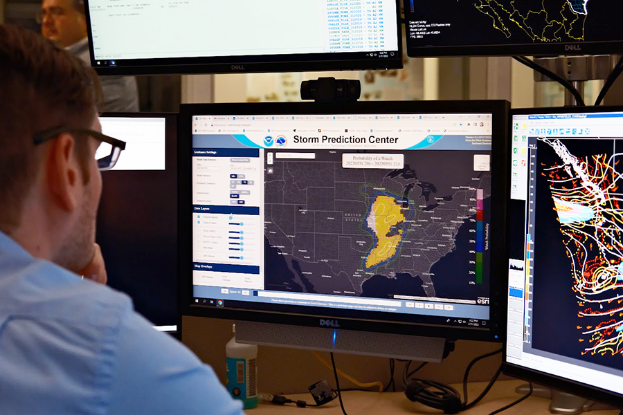
The SPC team at CIWRO serves as the research and development arm of the National Weather Service’s Storm Prediction Center. CIWRO-developed products and methods are created collaboratively with and specifically for the SPC to address operational needs. Products to enhance the forecasting of severe weather threats up to eight days in advance are developed and maintained by CIWRO scientists.

CIWRO keeps the United States' weather radar network at the cutting edge so it can deliver the most accurate, timely information to protect lives and property. The Weather Surveillance Radar – 1988 Doppler (WSR-88D), also known as NEXRAD, has served as the backbone of the National Weather Service’s severe weather detection and warning system for over 25 years.
Since 2016, the VORTEX program is focused on improving tornado forecasts with greater lead time through better observations, models, and risk communication. One primary goal is understanding how tornado environments impact their characteristics. These objectives directly address research priorities set by Congress.
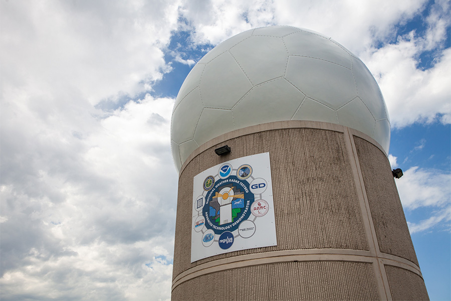
The Phased Array Radar Project is helping shape the future of weather radar in the United States. Unlike traditional radar, PAR can steer its beam electronically, allowing it to scan the atmosphere much faster. It can also focus on specific areas of interest and adapt to changing weather in real time. This means faster, more detailed updates during severe storms, which can lead to better warnings and more time to take action.
The Multi-Radar Multi-Sensor (MRMS) system combines various weather data sources into applicable products and visualizations to help with the prediction, communication, and warning of weather hazards. The MRMS system is jointly developed and maintained by CIWRO and NSSL.
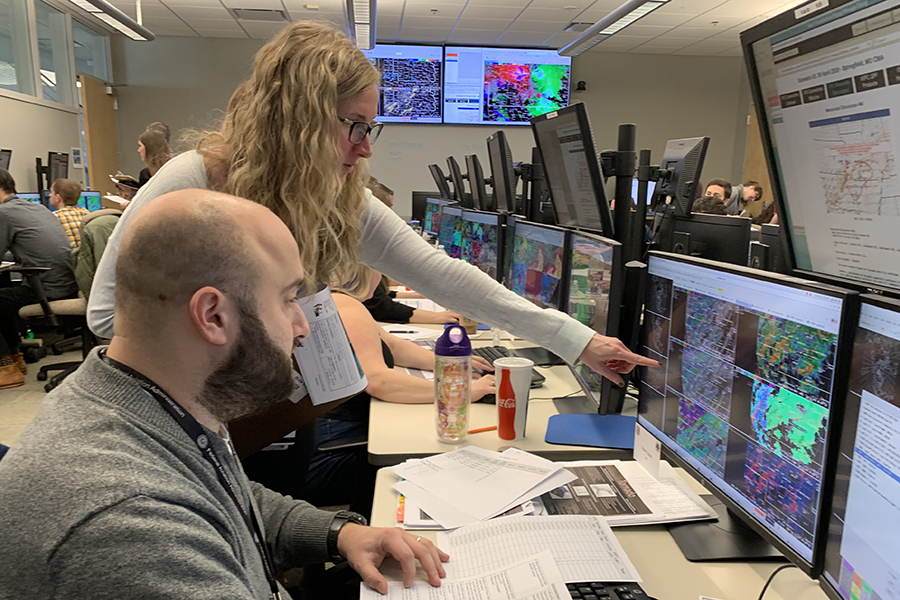
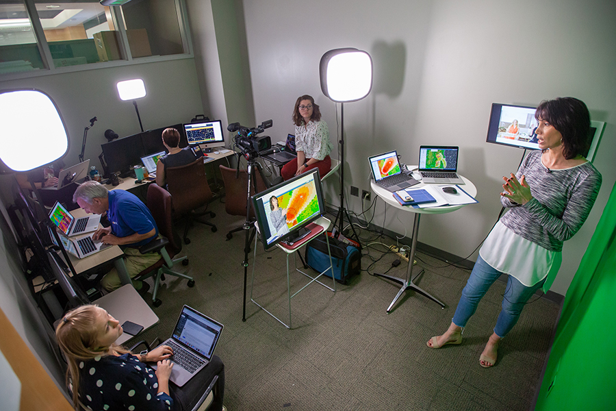
The National Weather Service historically staffs approximately 2,000 operational meteorologists, who require highly specialized training in science, technology, and human factors. CIWRO provides the NWS with the world's only "flight simulator" for meteorologists. The simulator replays real weather events that unfold exactly like they did in real time with the same software forecasters use for actual events.
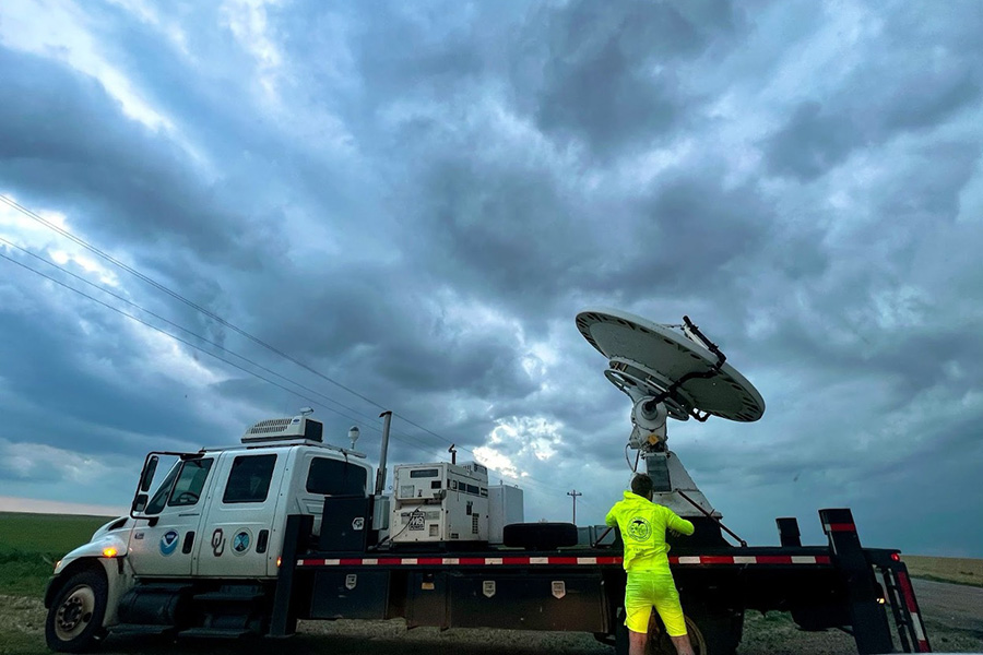
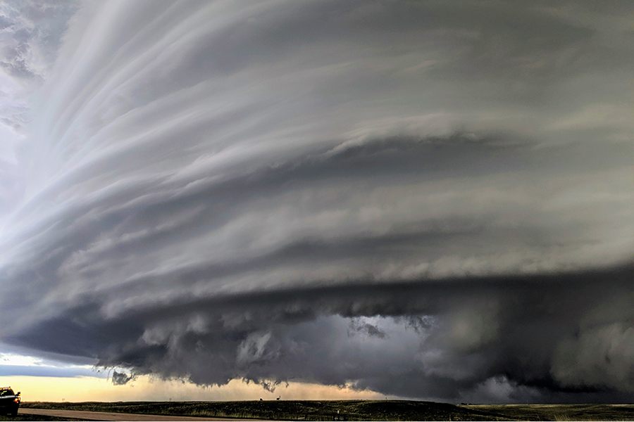
CIWRO field work explores the depths of the atmosphere, collecting data near the surface all the way to the tops of the most intense thunderstorms. Teams of skilled observational scientists and engineers deploy fleets of instrumentation around the world, harvesting key insights about high-impact weather ranging from tornadoes with baseball-size hail to electricity in extreme lake effect snowfall.

Researchers at CIWRO are revolutionizing weather observation and storm damage assessment through state-of-the-art UAS programs. Scientists pilot these aircraft from the ground and direct the drones' weather-sensing program to collect observations from critical data gaps in the lower atmosphere where most impactful weather develops.
In 2021, CIWRO added four consortium members to their cooperative institute to strengthen the research enterprise for severe and high impact weather research. Learn more about our consortium partners below.

CIWRO researchers work with NOAA colleguages and across multiple research labratories, centers, and offices. Learn more about out NOAA partners below.

CIWRO research staff support their research through external funding from a diverse range of sources. Learn more about our external partners below.