
A team of research scientists from the University of Oklahoma and the NOAA National Severe Storms Laboratory are on the road to Florida to collect data during the landfall of Hurricane Dorian. The data collected will allow for a better understanding of all hurricane components. This knowledge will aid in the development of cost-effective building codes to lessen future damage.
“We want to help mitigate property damage by working with engineers and using our data to improve the building and construction codes needed to develop a more resilient national infrastructure in the future,” said Michael Biggerstaff, OU School of Meteorology professor.
The team, led by Biggerstaff and Sean Waugh from the NOAA NSSL, is working closely with colleagues from Texas Tech University and the University of Florida-Gainesville. Collectively, these scientists are known as the Digital Hurricane Consortium.
OU students Jeffrey Stevenson, Alec Prosser, Jordan Laser, Noah Brauer and Addison Alford have been deployed to Hurricane Dorian. Alford developed a software tool that creates preliminary wind maps. These are distributed in near real-time to local emergency managers through the Office of Federal Coordinator in Meteorology and to federal agencies, including the NOAA NWS National Hurricane Center.
Biggerstaff has led radar deployments in 11 other landfalling tropical cyclones. Alford has participated in five and Brauer joined the team for the Florence deployment last year. Hurricane Dorian will be the first intercept for students Prosser, Laser and Stevenson.
The goal of the OU and NSSL project is to improve forecasts of damaging winds, deadly storm surge, and flooding associated with landfalling hurricanes.
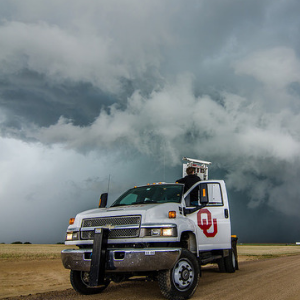
Data is collected using Shared Mobile Atmospheric Research and Teaching, or SMART, radars. These radars, provided by the OU Cooperative Institute for Mesoscale Meteorological Studies, are uniquely capable of producing high-resolution wind maps over a 60-by-60-mile area during hurricane landfalls. The wind profiles from the weather balloons released by NOAA NSSL support radar data to determine what factors contribute to structure failures.
For example, the damage to homes and businesses is associated with more than just the maximum wind speed. Wind gust, duration of extreme winds, water intrusion and the change in wind direction experienced by the structure during the wind event all impact building damage. Different parts of the hurricane create greater gust factors than other parts.
Through a partnership with AT&T and The Weather Channel, the SMART radar data and preliminary wind maps are also available online to the public once the radars are set up and operational. The camera links are: https://video.nest.com/live/6J5c8PIWhN and https://video.nest.com/live/g0FgtWh9RJ.
For more information about the OU SMART radar team, contact Biggerstaff at drdoppler@ou.edu or (405) 623-1769 or Alford at (901) 606-5823.
The project is funded by the National Institute for Standards and Technology under the Windstorm Impact Reduction program.