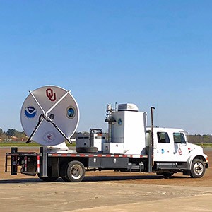
NORMAN—University of Oklahoma meteorologists, Michael Biggerstaff and Addison Alford, recently presented results collected from landfall of Hurricane Harvey in Corpus Christi, Texas, one year ago. Data collected with the OU Shared Mobile Atmospheric Research and Teaching and National Weather Service radars showed maximum sustained surface winds of 112 miles per hour. A Category 3 hurricane has sustained winds of 111 to 129 mph.
“SMART radar wind retrievals have been quality assured for seven hours around the time of landfall. The strongest winds over land were 112 mph near Bayside and Holiday Beach, Texas,” said Biggerstaff, SMART radar team leader. “Holiday Beach and Rockport, Texas, had mesovortices go directly overhead with significant damage in both locations.”
Alford, an OU doctoral student, developed automated analysis software to handle the nearly 19 hours of radar data collected during Hurricane Harvey. For the landfall period, he manually inspected the results to ensure accuracy.
Biggerstaff obtained wind measurements from seven StickNets deployed by Texas Tech University to validate the radar winds. The validation showed that the radar-derived surface winds were a few mph faster on average than anemometer winds. Despite the results obtained by the OU team, the hurricane caused significant damage as a result of the severe winds and several mesovortices that rotated around the inner edge of Harvey’s eyewall.
Wind tower data obtained from the University of Florida showed a one second wind gust of 178 mph in one of the mesovortices. The sustained or one-minute average wind speed was only 101 mph, which is associated with a Category 2 hurricane.
“Mesovortices are capable of producing short wind gusts that are twice the background winds compared to normal 30 to 40 percent enhanced winds found in gusts elsewhere in the hurricane,” said Biggerstaff. “Even though Harvey was not a Category 4 at landfall, the extreme wind gusts associated with the eyewall mesovortices contributed to localized damage. It is important to be mindful that a Category 4 hurricane is not necessary to cause the impacts felt from Harvey. Since Category 3 landfalls are likely to be more frequent than Category 4 landfalls, these events can occur more frequently than expected.”
The American Meteorological Society has accepted the wind tower and associated radar observations for publication in the AMS Bulletin. The research team submitted the 60 mile by 60 mile map of the maximum wind speeds approximately every half mile during the landfall of Harvey to the Geophysical Research Letters for publication. Biggerstaff and Alford presented the wind maps at the Hurricane Harvey Symposium in Port Arkansas, Texas, on Aug. 23.
A National Science Foundation Grant for Rapid Response Research provided support for this project. For more information about this research, contact Professor Biggerstaff at drdoppler@ou.edu or 405-623-1769.


