
“Understanding cloud-aerosol interactions in the north Atlantic is also important because the Arctic is warming faster than any other area on the planet, with the rate of warming faster than predicted by models,” McFarquhar said. “Better understanding how cloud/aerosol processes affect the water and energy budgets may improve the ability to model such processes.”
Over the Southern Ocean, data were collected during the field project Measurements of Aerosols Radiation and Clouds over the Southern Ocean using instrumentation from the U.S. Department of Energy Atmospheric Radiation Measurement Program Mobile Facility-2, which was installed on the Australian Research Supply Vessel Aurora Australis as it made resupply voyages between Hobart, Australia, and the Australian Antarctic research stations of Casey, Mawson and Davis, as well as Macquarie Island.
These data represent some of the most complete set of measurements on cloud and aerosol properties collected 60 degrees south over the Southern Ocean and over sea-ice. The collection also spans five months of time so that important seasonal cycles can be uncovered.
“The data are supplemented by a longtime series of cloud and aerosol properties collected over Macquarie Island during the Macquarie Island Cloud Radiation Experiment that allows for an enhanced understanding of the seasonal cycle at a single location,” McFarquhar said.
Over the north Atlantic, data are being collected during the DOE-funded Cold-Air Outbreaks in the Marine Boundary Layer Experiment to characterize cold-air outbreaks. Measurements are being made near Andenes in northeastern Norway, along with a reduced set of instruments on Bear Island, which is located approximately halfway between Andenes and Svalbard. These instruments are providing measurements of aerosol properties and surface fluxes as well as retrievals of cloud properties. OU researchers are using these measurements to study the relationship between cloud and aerosol properties for comparison against data collected over the Southern Ocean.
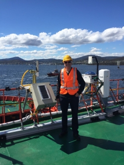
Image: Greg McFarquhar during the field project Measurements of Aerosols Radiation and Clouds over the Southern Ocean. The project will better inform weather prediction models, which have implications for understanding and predicting the effects of climate change.